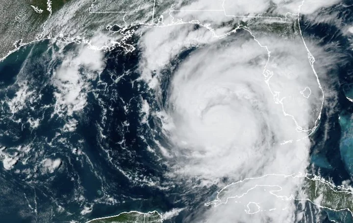
Hurricane Idalia is headed towards uncharted territory.
The storm, still intensifying, is expected to grow into a powerful class of hurricane, reaching Category 3 status (meaning winds over 111 mph) before making landfall Wednesday morning. It's on track to hit Florida's Big Bend region at a location no major hurricane — meaning Category 3 or higher — has ever historically landed.
"Hurricane #Idalia will likely be an unprecedented event for many locations in the Florida Big Bend," the Tallahassee National Weather Service office tweeted. "Looking back through recorded history, NO major hurricanes have ever moved through the Apalachee Bay. When you try to compare this storm to others, DON'T. No one has seen this."
"When you try to compare this storm to others, DON'T."Forecasters emphasized that "there are NO major hurricanes in the historical dataset going back to 1851 that have tracked into Apalachee Bay. None. Don't mess around with this."
SEE ALSO: See live Florida beach webcams as Hurricane Idalia nears, including Tampa BayCrucially, this region is quite vulnerable to storm surge — the ocean water pushed onto shore, at times violently, by a tropical storm's strong winds.
"The Florida Forgotten Coast and Big Bend are some of the most surge-prone areas in the world. The terrain is essentially flat inland a long way from the coast," Clark Evans, a professor of atmospheric sciences at the University of Wisconsin–Milwaukee, noted online.
The surge will be serious. The National Hurricane Center projects 10 to 15 feet of surge in the area from Aucilla River to Yankeetown, Florida. It will be "catastrophic," the agency underscored.
Idalia strengthened into a hurricane on Tuesday, and is expected to continue intensifying. That's a major reason why the winds, and accompanying storm surge, are so extreme. Hurricane Idalia is benefiting from profoundly warm ocean temperatures, which fuel the storm, as well as a lack of opposing winds (wind shear) that can diminish a storm's power.
"We expect it to rapidly intensify," Joel Cline, the National Weather Service Tropical Program manager, told Mashable on Monday evening. "This will be a rapid intensifier from a tropical storm."
The storm's potent rain bands will drop deluges in the Florida region, and beyond, too. "Heavy rainfall and the potential for tornadoes are forecast as well," the National Weather Service said. Follow guidance from local officials and don't ignore the danger posed by freshwater flooding. In recent years, freshwater flooding from heavy deluges has driven the majority of tropical storm-caused deaths.
"The rain will come down heavily at times," Tony Fracasso, a National Weather Service meteorologist, told Mashable.
How is Hurricane Idalia related to climate change?
Climate change is impacting hurricanes. Some of these impacts are clear, particularly more serious rainfall and historic flooding, along with higher storm surges. Other impacts, like how the relentless warming oceans are affecting how strong these storms grow, are an intensive and ongoing area of research.